


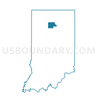
LIBERTY, Fulton County, Indiana
About
Outline

Summary
| Unique Area Identifier | 577226 |
| Name | LIBERTY |
| County | Fulton County |
| State | Indiana |
| Area (square miles) | 47.24 |
| Land Area (square miles) | 46.91 |
| Water Area (square miles) | 0.33 |
| % of Land Area | 99.31 |
| % of Water Area | 0.69 |
| Latitude of the Internal Point | 40.95707850 |
| Longtitude of the Internal Point | -86.24298260 |
Maps


Graphs
Select a template below for downloading or customizing gragh for LIBERTY, Fulton County, Indiana


Neighbors
Neighoring Voting District (by Name) Neighboring Voting District on the Map
- 30 ADAMS, Cass County, IN
- 38 BETHLEHEM, Cass County, IN
- ALLEN, Miami County, IN
- ROCHESTER 6, Fulton County, IN
- UNION, Miami County, IN
- WAYNE, Fulton County, IN
Top 10 Neighboring County Subdivision (by Population) Neighboring County Subdivision on the Map
- Rochester township, Fulton County, IN (10,181)
- Liberty township, Fulton County, IN (1,614)
- Adams township, Cass County, IN (895)
- Union township, Miami County, IN (857)
- Bethlehem township, Cass County, IN (795)
- Allen township, Miami County, IN (695)
- Wayne township, Fulton County, IN (569)
Top 10 Neighboring Place (by Population) Neighboring Place on the Map
Top 10 Neighboring Unified School District (by Population) Neighboring Unified School District on the Map
- Rochester Community School Corporation, IN (11,707)
- North Miami Community Schools, IN (6,007)
- Caston School Corporation, IN (4,626)
Top 10 Neighboring State Legislative District Lower Chamber (by Population) Neighboring State Legislative District Lower Chamber on the Map
Top 10 Neighboring State Legislative District Upper Chamber (by Population) Neighboring State Legislative District Upper Chamber on the Map
Top 10 Neighboring 111th Congressional District (by Population) Neighboring 111th Congressional District on the Map
Top 10 Neighboring Census Tract (by Population) Neighboring Census Tract on the Map
- Census Tract 9509, Cass County, IN (4,864)
- Census Tract 9520, Miami County, IN (4,767)
- Census Tract 9534, Fulton County, IN (2,786)
- Census Tract 9533, Fulton County, IN (2,008)
Top 10 Neighboring 5-Digit ZIP Code Tabulation Area (by Population) Neighboring 5-Digit ZIP Code Tabulation Area on the Map
- 46975, IN (14,691)
- 46951, IN (2,170)
- 46939, IN (2,101)
- 46988, IN (823)
- 46950, IN (643)
- 46931, IN (188)